The Geography of South Bey Limits
The two maps below are the same map. However, the second one is blown up in the area of and around Manions Lane. 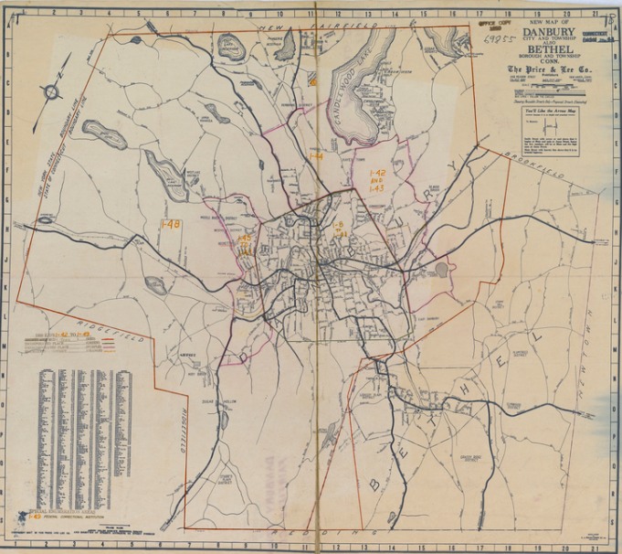
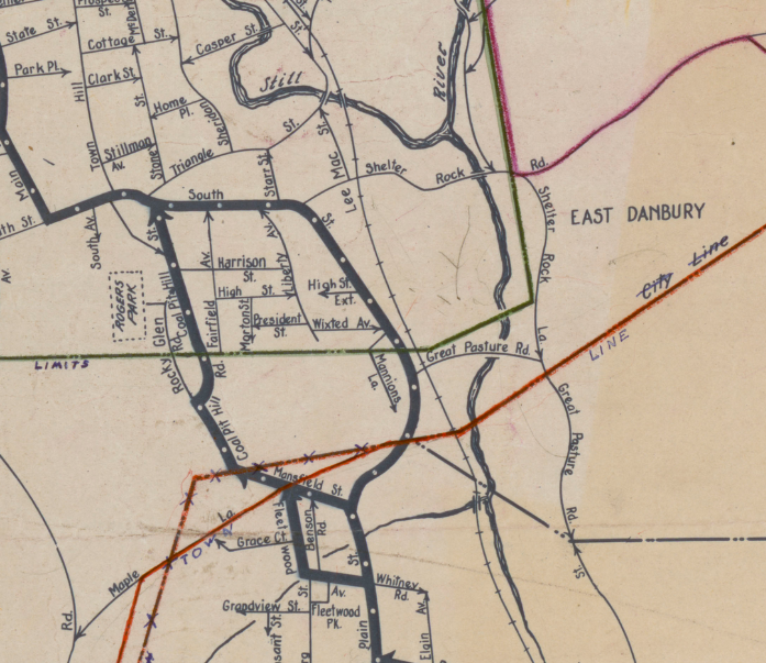
The map was published in 1950 but by 1950, it wasn’t 100% accurate. It is probably a more accurate 1945 map. When looking at Manions Lane, two things stick out. First, the green line shows us the demarcation point between the City of Danbury and the Town of Danbury. You’ll notice the Beginning of Manions Lane was in the city and the rest of it was in the town. The significance of this is that the town and city were two separate entities. The town had a Selectman and the City had a mayor and the rest of the governing bodies were completely different. Also, the Town of Danbury post office was way out in the Star’s Plain section. So, the mail being delivered to Manions lane at this time was coming from the Bethel post office. So, for many years, the mailing address of the houses on top of Manions Lane was “Bethel, Conn.” Actually, the address did change to Danbury after a couple decades of using this false address but the address wasn’t “Manions Lane, Danbury, Conn,” it was “MR19, Danbury, Conn.” It was apparent neither the City of Danbury or the town of Bethel wanted to lay claim to this small strip of land that lied between them. With the Town of Danbury serving areas like King St, Stars Plain and Mirey Brook, it did not seem too wild about South Bey Limits either.
The second thing that sticks out on the map about Manions Lane was that it was a dead end. Actually, by 1950, it probably was no longer a dead end but for many years it was. There was no road that passed by the Gozzi and Dachenhausen houses which was true because there were no Gozzi or Dachenhausen house in the area prior to about 1949. This meant there was no roads that connected Manions Lane to South St on the Bethel side of Carney’s Crossing. I have heard that this part of the road originally was cut in from South St to the Gozzi driveway and no further. Still, by 1950, the road was completed to be how it is now. In other words, there is a road from approximately where the arrow is on Manions Lane to South St.
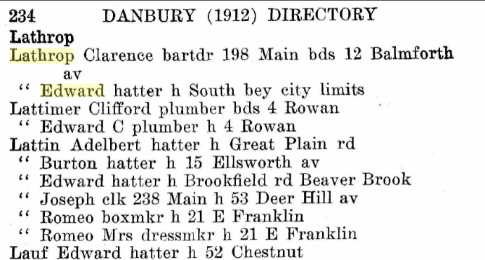
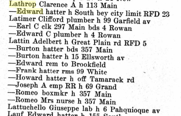
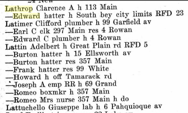
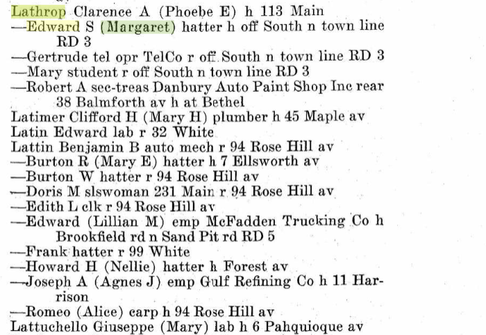
Manions Lane became Manions Lane in about 1931. Before that it was South St. Rd, South St extension or “Off South St.” At one point, they just referred to all the houses in the area as being on Carney’s crossing. Fortunately, that was not geographically correct! Before “Off South St,” the area was known as South Bey Limits. In those day, there was no road the houses of South Bey Limits sat next to. For part of this era, there simply were no cars and when cars came on the market, the people of South Bey Limits didn’t have any. So those on the top of hill of South Bey Limits walked to their houses through people’s yards taking what was the current path of least resistance, I would suppose. “Manions Lane”, south Street Ext”, etc. were names of roads, South Bey Limits was the name of a place. Before there was a named road, there had to be a horse path or walking path or something similar, it would seem, but there was no city or town road to attach a name to. We can see from looking at Thomas Keating and (Edward) Starr Lathrop entries in Danbury directories, the area was called South Bey Limits for roughly 30 years. In 1889, we see my Great Grandfather, Thomas Keating living in “South Beyond Limits!” It sounds like a place I frequented in the 60’s!
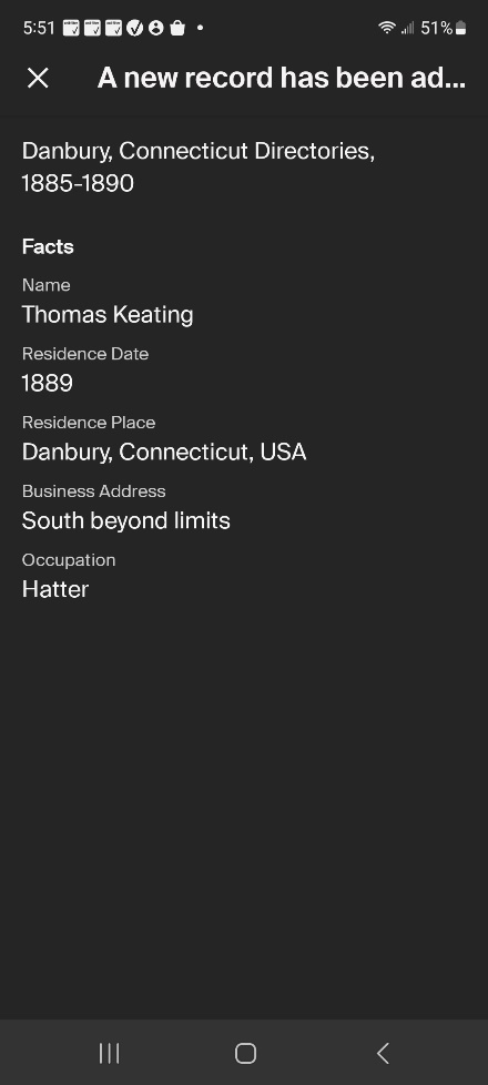
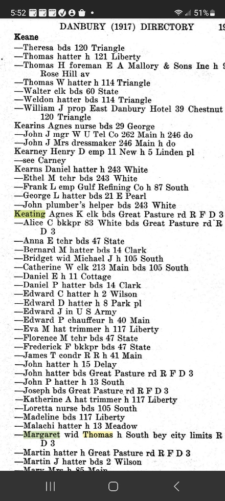
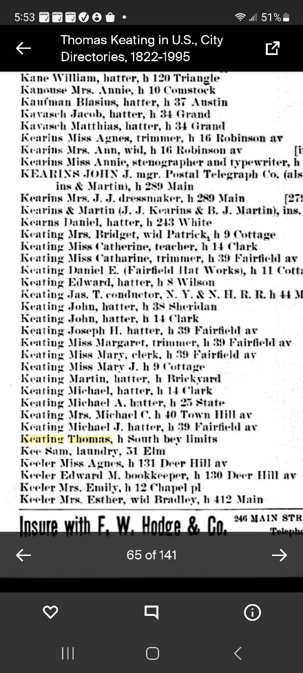
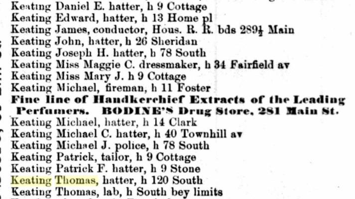
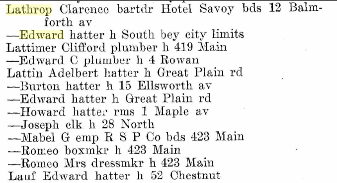
In the first directory above, you will see Thomas Keating, listed as a hatter. Perhaps he was a hatter in his first few years in Danbury. However, he was always a railroad worker or laborer and was listed as an “RR lab” in the 1900 census. So, he made have been a hatter for a while or the Thomas Keating listed was his son Thomas, though he was only 14 years old at the time.
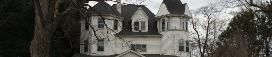
When South Bey Limits finally got a road, the first house on the road, and maybe the only people on the road to own a car lived in the James Manion home. So, it was the Manion family who applied for the permit to construct a private road. So, the private road, Manions Lane, was built!
For many years, the road was private and the upkeep of it was up to the people who lived on it. It also cost the people money to keep it private and it was up them to keep a “Private Road” sign near the beginning of the road.
At some point in time, I’m going to guess around 1957, the Manion family was no longer on Manions Lane. The last family member, Albert “Allie” Manion passed away on January 1st, 1956. The Town of Danbury, in the words of my father “took the road from us!’ Don’t be misled by this quote, he couldn’t have been happier as he continued, “Let them plow the snow!” In fact, when we thought the road was still private, we noticed that a town snowplow had driven through the road and cleared a deep snowfall. We had all thought someone who worked for the town was just being nice to us. After a few more of these serendipitous snow removals, we realized the town now owned the road. Let it snow!
The City of Danbury and the Town of Danbury consolidated in 1965. The only noticeable effect this had on the people in the area formerly known as South Bey Limits, aside from their taxes going up, was that their mailing address became “Manions Lane, Danbury, Ct” and almost immediately a road sign was erected that read “Mannions Lane” and the city has been misspelling Manions Lane ever since!
There are two more things I have noticed after looking at the map. The first is Rogers Park. You can find it by looking at where the green line intersects the misspelled “Mannions Lane” and following it to the left to Rocky Glenn and then looking north a bit. You will notice a short road from Rocky Glenn goes to Rogers Park and that’s it! That was all there was to Rogers Park in 1950.
The reason for this is The War Memorial wasn’t built until 1951. It wasn’t until the building of The War Memorial was completed that a road was cut in from the intersection of Main St and South St. I never remember Rogers Park being very much different than it is today so after a road was put in to allow you to park behind The Was Memorial, the development of Rogers Park as we know today must have happened very quickly, but in 1950, there wasn’t anything there.
Finally, there is one more thing I have to mention about the map. Part of the red line that separates Danbury from Bethel is x’d out. A mistake was made and no white out was available and the map wasn’t drawn with a computer program. So, we have benefited by being able to use a copy right free map. I think the x’s add a lot of charm to it! Ah! The good old days!
Skipper